
The beaches of Pollença, on one map
From long town beaches to coves you reach on foot or by boat
Pollença has 18 official beaches and coves along three very different stretches of coast: the calm bay of Port de Pollença, the four small coves of Cala Sant Vicenç, and the wild shoreline around Formentor. Tap any beach to see how to get there.
Which beach is right for your day?
Find your beach
Port de Pollença's inclusive beach: a free adapted-bathing service lets everyone reach the water, whatever their physical, mental or sensory ability.
- Drive up
- Sand
- Accessible
- Getting there
- Town beach in Port de Pollença.
- Facilities
- Free service with amphibious chairs (adults and children), crane, adapted hammock, walker, amphibious crutches, lifejackets, first-aid kits, safety rope, ID bracelets and an adapted pedal boat.
An extremely long, very narrow sandy stretch that is heavily developed yet keeps a quiet atmosphere. Six kilometres from Pollença.
- Drive up
- Sand
- Surface
- Coarse-grained sand, added when the beach was artificially extended.
- Getting there
- By car following local signs; bus stop a few metres from the sand.
- Parking
- Free car park.
A quiet, long and narrow beach 1.5 km from Port de Pollença, at the mouth of the Torrent de Sant Jordi. Open to the east wind, it is a favourite windsurfing spot that has hosted Spanish and European championships.
- Drive up
- Sand & pebbles
- Windsurf
- Surface
- Pebbles mixed with fine sand and seaweed.
- Sea & wind
- Unsheltered from the east wind: great for windsurfing. A free public breakwater at the east end serves as a landing stage for small boats on trailers.
Fine, soft sand among pines and tamarisks, close to the historic La Fortalesa. The seabed shelves so gently that the water is still only about 1 m deep 300 m from shore. A very popular beach.
- Drive up
- Sand
- Surface
- Fine, soft sand.
- Getting there
- Easy by car following signs; bus stop in the surrounding area.
- Parking
- Free parking area.
- Sea & wind
- Very gently shelving; not suitable for anchoring boats.
A small, unspoilt cove about 4 km from Port de Pollença, near the 17th-century Fortalesa. Gravel and large pebbles, limestone and scrub, and rarely crowded.
- Hike in
- Pebbles & rock
- Quiet
- Surface
- Gravel and large pebbles; a torrent reaches the sea here.
- Getting there
- Drive to the area near the aero-naval base and the Formentor turn-off, then a difficult walk of about 4 km. The council warns that the route crosses military areas where civilian access is prohibited: check locally before setting out.
- Sea & wind
- Poor anchoring: no shelter from easterly to southerly winds.
A small rocky inlet at the end of the Bóquer valley. The walk is the experience: about an hour past an old lime oven (active until 1935), the Cases de la Vall and the Font de la Cala.
- Hike in
- Pebbles & rock
- Surface
- Rocky inlet.
- Getting there
- On foot only, about 1 hour. The path starts in Port de Pollença on the left of the Formentor road and crosses private property (Possessió de Bóquer) through an iron gate.
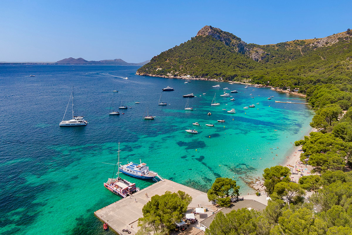
A long, narrow bay of very fine white sand, with Cala Gentil and Platja de Formentor, beside Hotel Formentor and the Formentor islet. Surrounded by pines and oaks.
- Drive up
- Sand
- Surface
- Very fine-grained, white, clear sand.
- Getting there
- Easy by car following signs; bus stop in the surrounding area.
- Parking
- Available near the bus stop.
A spectacular U-shaped inlet ending in a beach between cliffs, with Es Fumat (334 m) rising behind. The setting is scrub and lentisk, with pines only on the cliff tops.
- Short walk
- Sand & pebbles
- Surface
- Sand and pebbles, with some posidonia.
- Getting there
- Easy by car following signs; the beach is next to the road from Cap de Formentor. The final stretch of about 1,400 m is a dusty, stony track in poor condition.
- Sea & wind
- Anchoring is dangerous in north or north-east winds.
An S-shaped inlet ending in a semicircular beach where a torrent meets the sea. Pine-covered cliffs shelter it from northern winds and it is not very crowded.
- Hike in
- Sand & pebbles
- North-wind shelter
- Quiet
- Surface
- Gravel and sand on a nearly virgin beach.
- Getting there
- Easy by car to the turn-off for the Cala Murta estate (about 15 km from Port de Pollença); the final 1,700 m are on foot along a track, as access is restricted.
- Sea & wind
- Sheltered from northern winds.
A small, U-shaped virgin inlet with two little coves, below Puig de ses Butzes (162 m) and surrounded by high mountains and pine trees.
- Hike in
- Pebbles & rock
- Surface
- Mostly pebbles and gravel.
- Getting there
- Easy by car as far as Cala Murta, then a steep trail of about 2.5 km between cliffs.
- Sea & wind
- Good anchoring for boats.
An isolated, U-shaped inlet running about 200 m inland, with a pebble beach formed by a torrent and the sea, backed by steep rocks and high cliffs.
- Hike in
- Pebbles & rock
- Quiet
- Surface
- Stones and pebbles; no sand.
- Getting there
- On foot by one of two trails following the coast, from Hotel Formentor or from Cala Murta; also by boat.
- Sea & wind
- Good anchoring conditions.
A wild beach at the foot of a cliff, split into two coves between Punta Galera and Punta Topina, 12.8 km from Pollença.
- By sea
- Sand & pebbles
- Quiet
- Surface
- Pebbles, gravel and sand, with some posidonia.
- Getting there
- By sea only.
- Sea & wind
- Waters suit anchoring but become unsafe when the wind blows from the north.
A small, isolated cove in a deep U-shaped inlet between steep cliffs, with an 8 m sea cave. Water flows in from a canyon even in summer.
- By sea
- Pebbles & rock
- Quiet
- Surface
- Pebbles, stones and gravel; no sand.
- Getting there
- By car to Cala Sant Vicenç, then a very steep, dangerous path along a torrent. The council recommends arriving by sea, in a small boat.
- Sea & wind
- Anchoring not recommended: deep, stony seabed and frequent strong north and north-east winds.
The sandy beach of Cala Sant Vicenç, about 7 km from Pollença, with a small jetty and the village around it.
- Drive up
- Sand
- Getting there
- By car following the signs; the last stretch is down steps that are not adapted for people with reduced mobility. Bus stop near the beach.
- Parking
- Free parking area.
- Sea & wind
- Good anchoring, but beware of flagstones less than 1 m deep about 200 m offshore, and of NNE winds.
A small cove named for the colour of its fine white sand, separated from Cala Molins by Punta de la Torre.
- Drive up
- Sand
- Surface
- White, fine-grained sand.
- Getting there
- By car as far as Cala Barques, following signs; the last 100 m are on foot. Bus stop a few metres away.
- Parking
- Free parking area for private cars.
A clear-water cove with a stony shoreline and a sandy, weedy seabed. Cold north winds can make it choppy. It is the Cala Sant Vicenç beach with a lifeguard and a lift for people with reduced mobility.
- Drive up
- Pebbles & rock
- Accessible
- Surface
- Stony shoreline; sandy seabed with seaweed.
- Getting there
- Easy by car following signs; bus stop near the beach.
- Parking
- Free car park at the rear; if full, use the village streets.
- Facilities
- Lifeguard and a lift for people with reduced mobility.
A small, uncrowded headland (Punta de sa Torre) between Cala Molins and Cala Clara, with panoramic views, a sea promenade and low rocky cliffs to jump in from.
- Drive up
- Pebbles & rock
- Quiet
- Surface
- Pebbles and low rocky cliffs; steep slope and reefs.
- Getting there
- By car following signs; bus stop nearby.
- Parking
- Free parking in the surroundings.
- Sea & wind
- Dangerous with strong north, north-east or east winds.
A small, wonderful inlet sheltered from the dangerous north winds by cliffs, and the least frequented of the four coves of Cala Sant Vicenç.
- Drive up
- Pebbles & rock
- North-wind shelter
- Quiet
- Surface
- Sand, seaweed and gravel on a steep slope; some pebbles and posidonia remains.
- Getting there
- Easy by car following signs; the nearest bus stop is about 300 m away.
- Parking
- Park on the road if you find a space.
- Facilities
- No tourist facilities.
- Sea & wind
- Sheltered from the north winds by the cliffs.
No beach matches all these filters.
Plan your beach day
The north-facing coves can turn choppy or unsafe when the wind blows from the north or north-east. On those days, Cala Carbó and Cala Murta are sheltered from northern winds, and the Port de Pollença bay is the calmer choice.
Bóquer is about an hour on foot and crosses private land through an iron gate. The last 1,700 m to Cala Murta and 2.5 km to Cala en Gossalba are on foot too. Bring water, sturdy shoes and a bag for your rubbish.
Free car parks serve Cala Barques, Cala Clara, Cala Molins, Albercuix and Port de Pollença Beach, and the Cala Sant Vicenç coves are small. Bus stops are close to most of the drive-up beaches.
Cala Castell can only be reached by sea and the council recommends arriving at Cala Estremer by boat. Anchor away from the shore and never in unsafe wind conditions.
Seaweed and posidonia remains on the beach are part of the natural ecosystem. Please leave them in place, take your litter home and keep to marked paths.
Access, services and restrictions change. The route to El Caló, for example, crosses military areas where the council says civilian access is prohibited. Confirm on site or with the tourist office.
Beach data (GPS positions, access, parking and facilities) comes from the official pages of the Ajuntament de Pollença, which also publishes a printable beach guide (PDF). Always check conditions on the day. Looking beyond Pollença, to Alcúdia, Muro and Son Serra de Marina? Read our Journal guide to the best beaches in North Mallorca.
Beaches of Pollença: quick answers
How many beaches are there in Pollença?
The Ajuntament de Pollença lists 18 beaches and coves across three stretches of coast: Port de Pollença bay, the four coves of Cala Sant Vicenç, and the wilder shoreline around Formentor and the north coast.
Which Pollença beach is best for families?
Albercuix Beach has fine, soft sand and a seabed that shelves so gently the water is only about 1 m deep 300 m from shore. It has a free parking area and a bus stop nearby.
Which beaches are accessible for people with reduced mobility?
Tamarells Beach in Port de Pollença offers a free adapted-bathing service with amphibious chairs, a crane and an adapted pedal boat. Cala Molins has a lifeguard and a lift for people with reduced mobility.
Which beaches can only be reached on foot or by sea?
Cala Castell is reached by sea only, and the council recommends arriving at Cala Estremer by boat. Cala Bóquer, Cala Murta, Cala en Gossalba, Cala en Feliu and El Caló are walk-in coves.
Where can I windsurf near Port de Pollença?
Can Cullerassa Beach, 1.5 km from Port de Pollença. It is open to the east wind and has hosted Spanish and European windsurfing championships.
Can I drive to Cala Murta?
Not all the way. You can drive to the turn-off for the Cala Murta estate, but access is restricted and the final 1,700 m are on foot along a track.
Wake up a few minutes from the water
Our villas and fincas in Pollença and Puerto Pollensa put these beaches within easy reach.
Walk-to-beach villas All villas in Pollensa